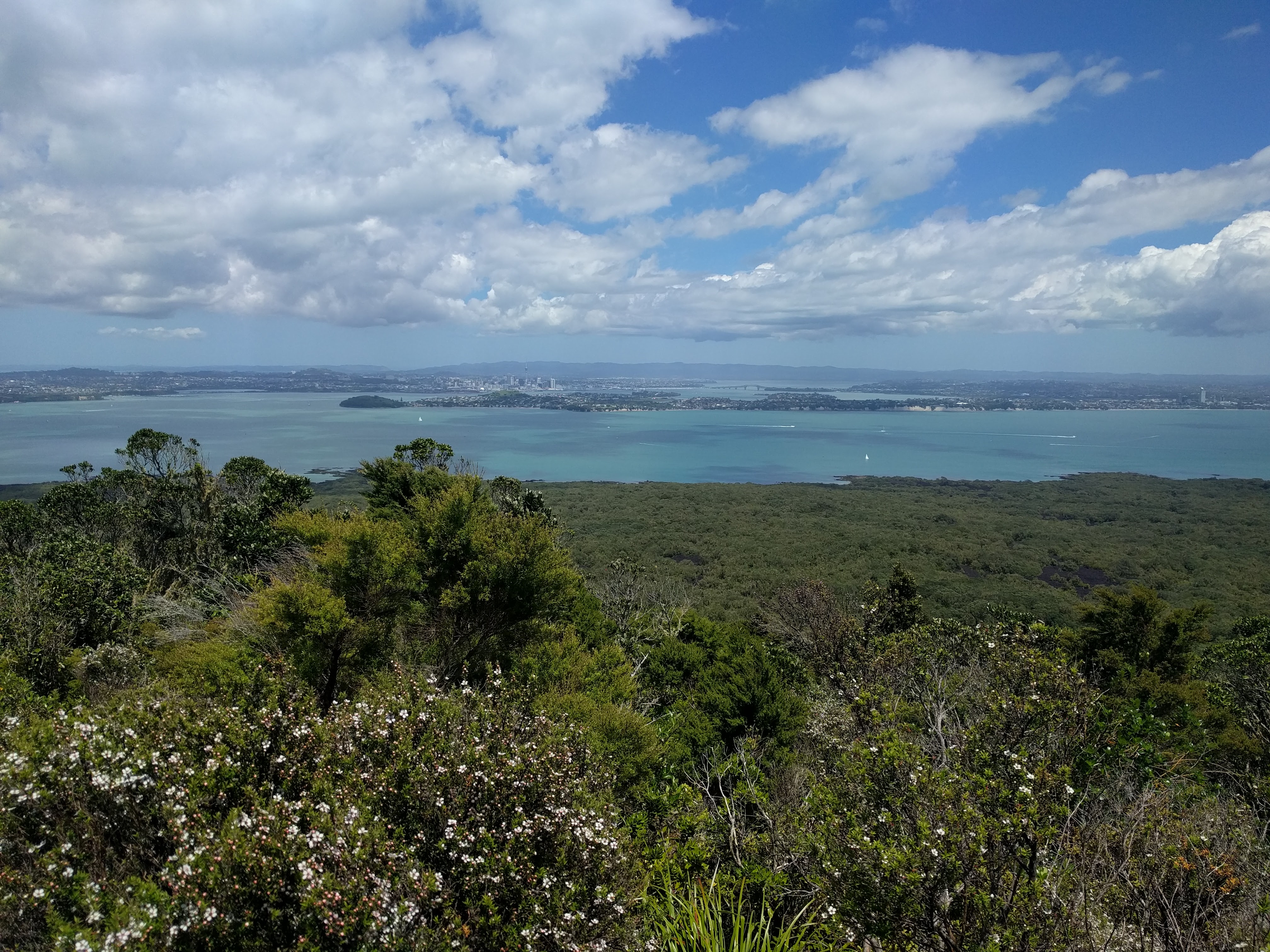
View from Rangitoto summit
A densely wooded island offering a good day’s worth of hiking through spectacular foliage with vistas of the city and the sea from the summit. Views like this are the times I wish I had a camera rather than my phone for taking pictures. The view cannot be done justice with a simple phone camera. There are also caves created by the lava flow which you can climb through. Nearly pitch black, you need a flashlight (or a phone for the unprepared) to be able to see in them.
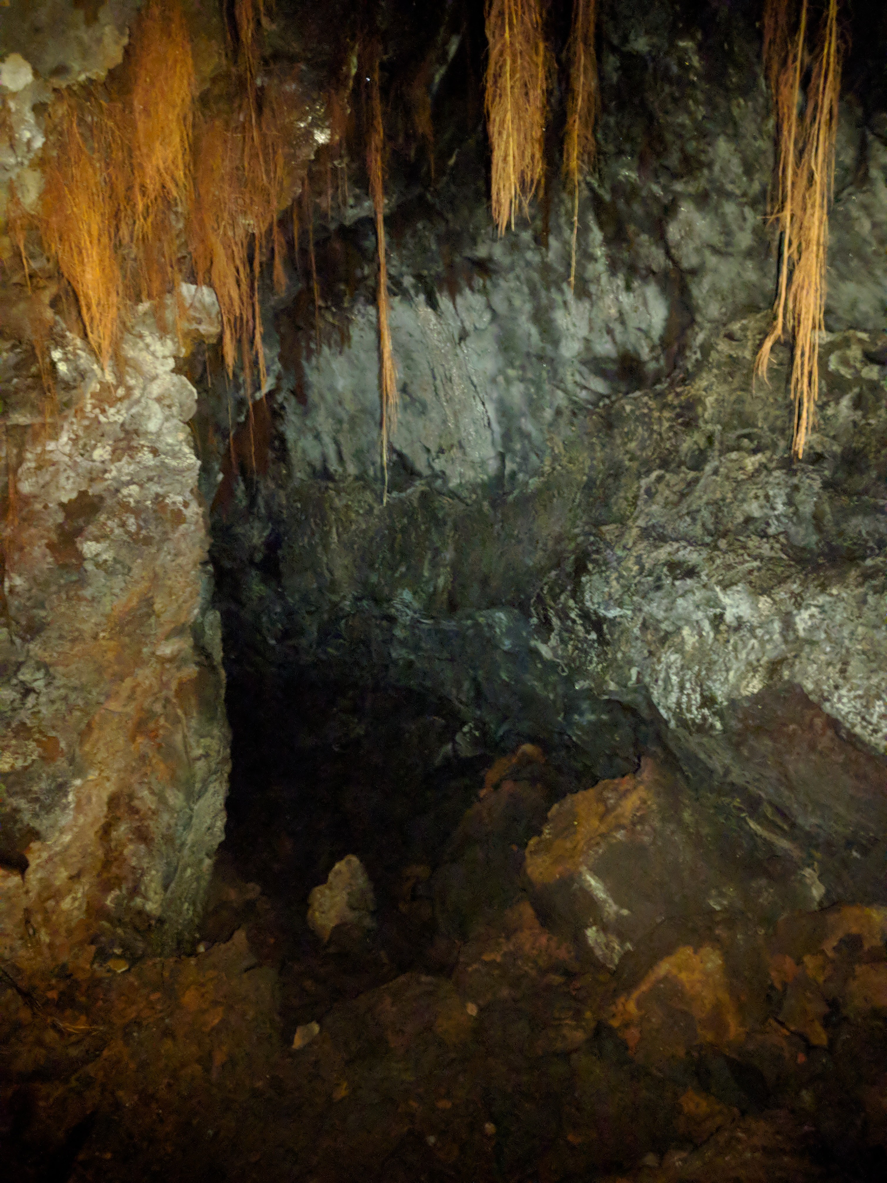
The lava caves in Rangitoto
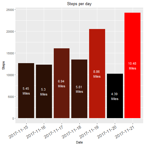
The low day I spent mostly on online related tasks including searching for a car and writing my previous post. I’m attempting to keep up my coding skills while I am here, and while I have already automated creating the graph (and another one which I decided not to use) I am also working on learning python to scrape the Fitbit website for this data automatically. We’ll see how long that takes me, as I haven’t been very dedicated to trying to learn it yet. I have a few good leads on cars, so it is likely I will be leaving Auckland for camping excursions by the end of the week, which means without a consistent internet connection my learning python will be quite slowed. Oh well. ¯\_(ツ)_/¯


I just love traveling with you Tanner.